Trincomalee
The recorded history of Trincomalee spans more than two and a half thousand years, beginning with civilian settlement associated with the Koneswaram temple in the pre-modern era. One of the oldest cities in Asia, it has served as a major maritime seaport in the international trading history of the island with South East Asia. From its suburban village of Kankuveli, some of Asia's earliest medical research at the "Agathiyar Thapanam", the Siddhar Tamil medical university established by Agastya, helped spread Tamil Tamraparniyan culture across the continent. In the ancient world, it was successively the capital of eastern kingdoms of the Vanni country, developing under the Anuradhapura Kingdom, Pallava Dynasty, Chola Dynasty, Pandyan Dynasty, the Vannimai chieftaincies and the Jaffna kingdom through the Koneswaram shrine's revenue. Trincomalee's urbanization continued when made into a fortified port town following the Portuguese conquest of the Jaffna kingdom, changing hands between the Danish in 1620, the Dutch, the French following a battle of the American Revolutionary War and the British in 1795, being absorbed into the British Ceylon state in 1815. The city's architecture shows some of the best examples of interaction between native and European styles. Attacked by the Japanese as part of the Indian Ocean raid during World War II in 1942, the city and district were affected after Sri Lanka gained independence in 1948, when the political relationship between Tamil and Sinhalese people deteriorated, erupting into civil war. It is home to major naval and air force bases at the Trincomalee Garrison. The city also has the largest Dutch fort on the island.
The Trincomalee Bay, bridged by the Mahavilli Ganga River to the south, the historical "Gokarna" in Sanskrit, means "Cow's Ear", akin to other sites of Siva worship across the Indian subcontinent. Uniquely, Trincomalee is a Pancha Ishwaram, a Paadal Petra Sthalam, a Maha Shakti Peetha and Murugan Tiruppadai of Sri Lanka; its sacred status to the Hindus has led to it being declared "Dakshina-Then Kailasam" or "Mount Kailash of the South" and the "Rome of the Pagans of the Orient". The harbour is renowned for its large size and security; unlike any other in the Indian Ocean, it is accessible in all weathers to all craft. It has been described as the "finest harbour in the world" and by the British, "the most valuable colonial possession on the globe, as giving to our Indian Empire a security which it had not enjoyed from elsewhere". Popular tourist destinations include its beaches at Uppuveli, Salli and Nilaveli, used for temple visits, surfing, scuba diving, fishing and whale watching, and the Kanniya Hot Springs. Trincomalee is served by a campus of the Eastern University, Sri Lanka and has been the inspiration of both domestic and international poetry, films, music and literature for many centuries.
Map - Trincomalee
Map
Country - Sri_Lanka
 |
 |
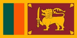
| Flag of Sri Lanka | |
Sri Lanka has a population of around 22 million (2020) and is a multinational state, home to diverse cultures, languages, and ethnicities. The Sinhalese are the majority of the nation's population. The Tamils, who are a large minority group, have also played an influential role in the island's history. Other long established groups include the Moors, the Burghers, the Malays, the Chinese, and the indigenous Vedda.
Currency / Language
| ISO | Currency | Symbol | Significant figures |
|---|---|---|---|
| LKR | Sri Lankan rupee | Rs රු or ரூ | 2 |
| ISO | Language |
|---|---|
| EN | English language |
| SI | Sinhala language |
| TA | Tamil language |


